
Mesoscale Severe Weather
1
Development of hazardous weather prediction system in aviation

Convective hazards
Deep convection produces high-impact hazards such as heavy rainfall, lightning, and strong winds, which develop through interactions between large-scale environments and mesoscale processes, making their timing, location, and intensity challenging to predict.
We investigate heavy rainfall events (HREs), orographic precipitation, and lightning using diverse ground-based, satellite, and in-situ observations, together with reanalysis data and high-resolution simulations. Combining process-oriented case studies with long-term analyses of recurrent environments and organizational patterns, we seek to improve the understanding and predictability of mesoscale severe weather over South Korea.
Heavy Rainfall Events
HREs are among the most damaging weather hazards in South Korea, with strong spatial and temporal variability. Using intensive observations, reanalysis data, and high-resolution simulations, we investigate how mesoscale processes such as localized convergence, convective outflows, and orographic effects enhance precipitation under favorable synoptic conditions.
Orographic Precipitation
The northeastern part of South Korea experiences exceptionally complex weather due to orographic and oceanic effects, making it vulnerable to HREs during summer and early autumn. We classified HREs into mountainous and coastal types, which share similar synoptic patterns but differ in sub-synoptic factors, and have extended this classification toward conceptual models and forecast guidance for operational use.
Mesoscale Convective Systems
MCSs produce widespread and intense rainfall, accounting for a substantial portion of warm-season and extreme precipitation. Using long-term high-resolution radar, surface observations, and reanalysis data, we objectively identify and track MCSs over South Korea, classifying their organizational structures and examining how different modes contribute to heavy rainfall.
Downslope Windstorm
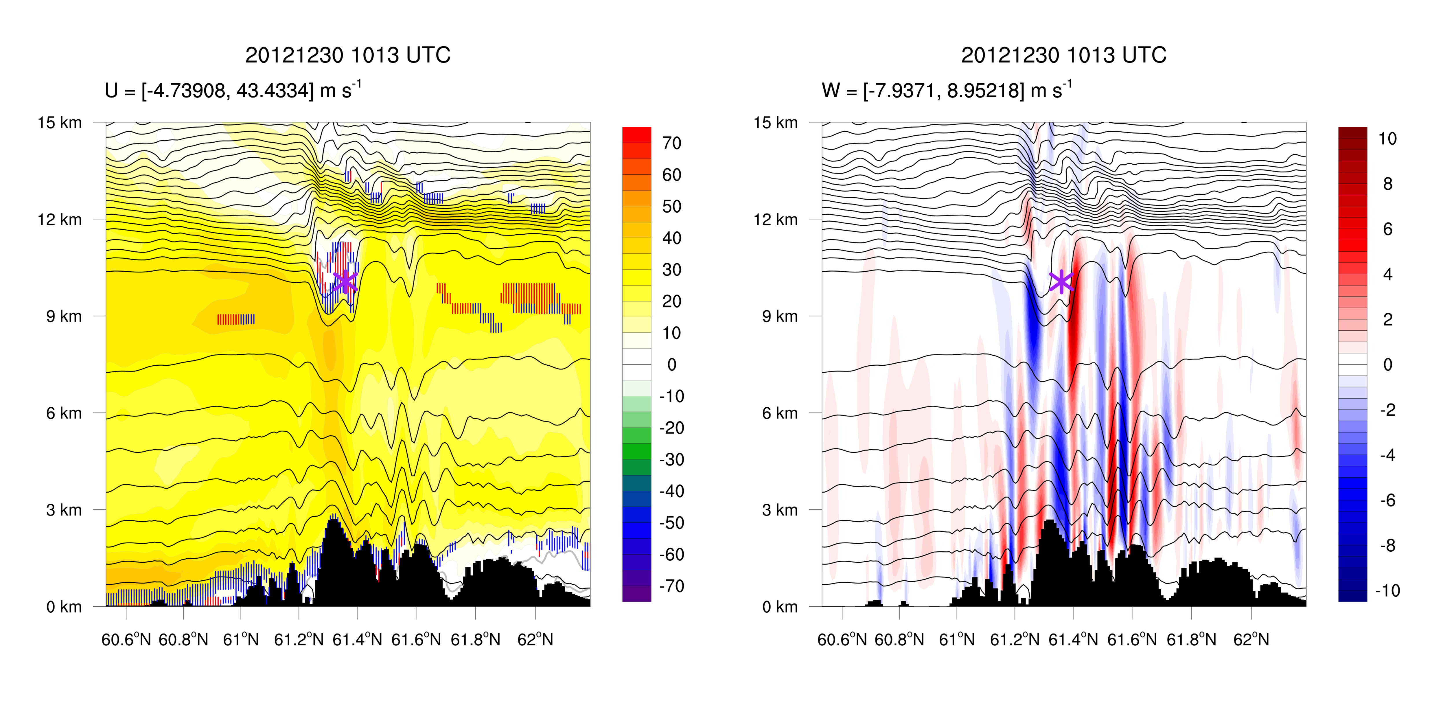
Downslope windstorms develop as airflow accelerates down the lee slope of a mountain range, driven by mesoscale mountain waves (orographic gravity waves) including hydraulic jumps and wave reflections. Because they can cause substantial structural damage, aviation accidents, and widespread wildfires, understanding their mechanisms and long-term characteristics is essential for disaster response and preparedness.
In Korea, downslope windstorms are frequently observed in the Yeongdong region (east of the Taebaek Mountains) and the Yeongnam region (southwest of the Sobaek Mountains), occurring predominantly during spring and winter under various synoptic-scale patterns and background flow conditions.
To investigate their generation mechanisms, we have classified synoptic-scale patterns, conducted high-resolution numerical simulations from mesoscale modeling to large eddy simulations, and utilized multiple observations from surface stations, radiosondes, wind profilers, and lidars. More recent work has examined their long-term characteristics and potential future changes.

Fog
Sea fog significantly reduces horizontal visibility and is a serious hazard to aviation and maritime transportation, particularly over the Yellow Sea, one of the world’s most fog-prone seas. It is classified as cold or warm sea fog according to the air–sea temperature difference (ASTD), which reflects different air–sea interaction and boundary-layer processes.
Previous studies have emphasized the roles of sea-surface temperature, turbulent heat exchange, advection, and long-wave radiative (LWR) cooling in Yellow Sea fog formation. Fog with a marginal ASTD can transition from cold to warm as the sign of ASTD changes, altering surface heat fluxes and stratification.
We investigated a locally initiated sea-fog event over the eastern Yellow Sea that affected aircraft operations at Incheon International Airport, using high-resolution WRF simulations to quantify radiative, turbulent, microphysical, and advective processes and to examine sensitivity to PBL and surface-layer parameterizations. LWR cooling dominated the initial fog formation, followed by an ASTD transition that generated buoyancy-driven turbulence and promoted vertical fog growth.